Geolocate

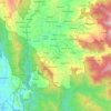
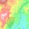
Tobalu topographic map

Click on the map to display elevation.

About this map

Name: Tobalu topographic map, elevation, terrain.

Location: Tobalu, Enrekang, South Sulawesi, Sulawesi, Indonesia (-3.51820 119.83989 -3.47820 119.87989)

Average elevation: 983 m

Minimum elevation: 462 m

Maximum elevation: 1,568 m

Other topographic maps

Click on a map to view its topography, its elevation and its terrain.
Bungin

Indonesia > South Sulawesi > Enrekang

Average elevation: 1,238 m

Baraka

Indonesia > South Sulawesi > Enrekang

Average elevation: 827 m

Buntu Batu

Indonesia > South Sulawesi > Enrekang

Average elevation: 1,459 m

Cendana

Indonesia > South Sulawesi > Enrekang

Average elevation: 152 m

Malua

Indonesia > South Sulawesi > Enrekang

Average elevation: 709 m

Alla

Indonesia > South Sulawesi > Enrekang

Average elevation: 1,037 m

Malua

Indonesia > South Sulawesi > Enrekang

Average elevation: 709 m

Maiwa

Indonesia > South Sulawesi > Enrekang

Average elevation: 214 m

Gear up for your next adventure:

👖Convertible Hiking Pants - Zip-off legs to adapt to changing weather conditions
🛶Waterproof Dry Bags - Keep electronics and clothes dry during river crossings
🎒Backpack Rain Cover - External shield to keep your entire pack dry
🥤Collapsible Travel Cup - Saves space and weight in your mess kit
🛌Insulated Sleeping Pad - Critical thermal barrier between you and the cold ground

As an Amazon Associate, this site earns from qualifying purchases at no extra cost to you.