Geolocate

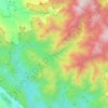
Rosoan topographic map

Click on the map to display elevation.

About this map

Name: Rosoan topographic map, elevation, terrain.

Location: Rosoan, Enrekang, South Sulawesi, Sulawesi, 91712, Indonesia (-3.51062 119.79753 -3.47062 119.83753)

Average elevation: 518 m

Minimum elevation: 133 m

Maximum elevation: 1,440 m

Other topographic maps

Click on a map to view its topography, its elevation and its terrain.
Baraka

Indonesia > South Sulawesi > Enrekang

Average elevation: 827 m

Bungin

Indonesia > South Sulawesi > Enrekang

Average elevation: 1,238 m

Cendana

Indonesia > South Sulawesi > Enrekang

Average elevation: 152 m

Buntu Batu

Indonesia > South Sulawesi > Enrekang

Average elevation: 1,459 m

Alla

Indonesia > South Sulawesi > Enrekang

Average elevation: 1,037 m

Malua

Indonesia > South Sulawesi > Enrekang

Average elevation: 709 m

Malua

Indonesia > South Sulawesi > Enrekang

Average elevation: 709 m

Maiwa

Indonesia > South Sulawesi > Enrekang

Average elevation: 214 m

Gear up for your next adventure:

🕯️Camping Lantern - Illuminates your entire campsite with high-efficiency LEDs
💡Solar Camping Lamp - Eco-friendly lighting for campsites
🔦LED Headlamp - Hands-free lighting for early morning starts or late finishes
🚲Bike Repair Kit - Essential tools for on-trail mechanical issues
🥾Waterproof Hiking Shoes - Durable shoes for wet and rugged trails

As an Amazon Associate, this site earns from qualifying purchases at no extra cost to you.