Geolocate

Buttu Seka topographic map

Click on the map to display elevation.

About this map

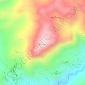
Name: Buttu Seka topographic map, elevation, terrain.

Location: Buttu Seka, Enrekang, South Sulawesi, Sulawesi, Indonesia (-3.30405 119.91395 -3.30395 119.91405)

Average elevation: 829 m

Minimum elevation: 603 m

Maximum elevation: 1,042 m

Other topographic maps

Click on a map to view its topography, its elevation and its terrain.

Malua

Indonesia > South Sulawesi > Enrekang

Average elevation: 709 m

Buntu Batu

Indonesia > South Sulawesi > Enrekang

Average elevation: 1,459 m

Bungin

Indonesia > South Sulawesi > Enrekang

Average elevation: 1,238 m

Cendana

Indonesia > South Sulawesi > Enrekang

Average elevation: 152 m

Maiwa

Indonesia > South Sulawesi > Enrekang

Average elevation: 214 m

Malua

Indonesia > South Sulawesi > Enrekang

Average elevation: 709 m

Alla

Indonesia > South Sulawesi > Enrekang

Average elevation: 1,037 m

Baraka

Indonesia > South Sulawesi > Enrekang

Average elevation: 827 m

Gear up for your next adventure:

👟Sport Hiking Sandals - Breathable footwear for water crossings and camp rest
🛌Down Sleeping Bag - Superior warmth-to-weight ratio for cold nights
🔦LED Headtorch - Bright and durable light for night activities
🕯️Camping Lantern - Illuminates your entire campsite with high-efficiency LEDs
🧦Hiking Socks - Moisture-wicking and comfortable socks for long hikes

As an Amazon Associate, this site earns from qualifying purchases at no extra cost to you.