Geolocate

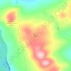
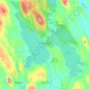
Mackamp topographic map

Click on the map to display elevation.

About this map
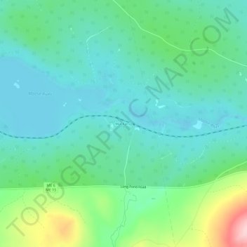
Name: Mackamp topographic map, elevation, terrain.

Location: Mackamp, Long Pond Township, Somerset County, Maine, United States (45.59477 -70.02506 45.63477 -69.98506)

Average elevation: 395 m

Minimum elevation: 344 m

Maximum elevation: 556 m

Other topographic maps

Click on a map to view its topography, its elevation and its terrain.

Embden

United States > Maine > Somerset County

Average elevation: 143 m

The Forks

United States > Maine > Somerset County

Average elevation: 353 m

Jackman

United States > Maine > Somerset County

Average elevation: 413 m

Harmony

United States > Maine > Somerset County

Average elevation: 146 m

Pittsfield

United States > Maine > Somerset County

Average elevation: 80 m

Bingham

United States > Maine > Somerset County

Average elevation: 205 m

Palmyra

United States > Maine > Somerset County

Average elevation: 93 m

Fairfield

United States > Maine > Somerset County

Average elevation: 64 m

Canaan

United States > Maine > Somerset County

Average elevation: 100 m

Anson

United States > Maine > Somerset County

Average elevation: 123 m

Norridgewock

United States > Maine > Somerset County

Average elevation: 97 m

Caratunk

United States > Maine > Somerset County

Average elevation: 373 m

Anson

United States > Maine > Somerset County

Average elevation: 123 m

Moscow

United States > Maine > Somerset County

Average elevation: 313 m

Palmyra

United States > Maine > Somerset County

Average elevation: 93 m

Hartland

United States > Maine > Somerset County

Average elevation: 111 m

Skowhegan

United States > Maine > Somerset County

According to the United States Census Bureau, the town has a total area of 60.47 square miles (156.62 km2), of which 58.85 square miles (152.42 km2) is land and 1.62 square miles (4.20 km2) is water. Skowhegan is drained by the Wesserunsett Stream and Kennebec River. Loomis Hill, elevation 870 feet (265…

Average elevation: 101 m

Skowhegan

United States > Maine > Somerset County

According to the United States Census Bureau, the town has a total area of 60.47 square miles (156.62 km2), of which 58.85 square miles (152.42 km2) is land and 1.62 square miles (4.20 km2) is water. Skowhegan is drained by the Wesserunsett Stream and Kennebec River. Loomis Hill, elevation 870 feet (270…

Average elevation: 95 m
Cornville

United States > Maine > Somerset County

Average elevation: 115 m

Pittsfield

United States > Maine > Somerset County

Average elevation: 80 m

Cornville

United States > Maine > Somerset County

Average elevation: 115 m

Ripley

United States > Maine > Somerset County

Average elevation: 147 m

Mercer

United States > Maine > Somerset County

Average elevation: 118 m

Cambridge

United States > Maine > Somerset County

Average elevation: 171 m

Madison

United States > Maine > Somerset County

Average elevation: 124 m

Fairfield

United States > Maine > Somerset County

Average elevation: 64 m

Smithfield

United States > Maine > Somerset County > Smithfield

Average elevation: 105 m

Gray Island

United States > Maine > Somerset County > Solon

Average elevation: 105 m

Canaan

United States > Maine > Somerset County

Average elevation: 101 m

Fairfield

United States > Maine > Somerset County

Average elevation: 64 m

Skowhegan

United States > Maine > Somerset County

According to the United States Census Bureau, the town has a total area of 60.47 square miles (156.62 km2), of which 58.85 square miles (152.42 km2) is land and 1.62 square miles (4.20 km2) is water. Skowhegan is drained by the Wesserunsett Stream and Kennebec River. Loomis Hill, elevation 870 feet (270…

Average elevation: 101 m

Jackman

United States > Maine > Somerset County

Average elevation: 413 m

Norris Brook

United States > Maine > Somerset County

Average elevation: 420 m

Gear up for your next adventure:

🥾Mountain Trail Shoes - High-traction shoes for mountain trails
🔦LED Flashlight - Powerful and long-lasting flashlight for camping and emergencies
🧦Crew Hiking Socks - Comfortable socks for long-distance hikes
🥾Hiking Boots - Sturdy boots providing ankle support and traction on rugged trails
⛺Lightweight Backpacking Tent - Compact tent for efficient hiking trips

As an Amazon Associate, this site earns from qualifying purchases at no extra cost to you.