Geolocate

The Forks topographic map

Click on the map to display elevation.

About this map
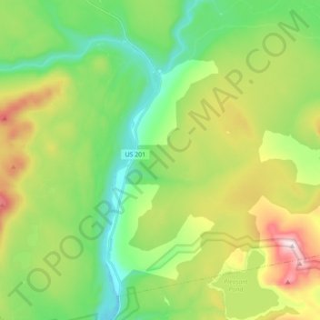
Name: The Forks topographic map, elevation, terrain.

Location: The Forks, Somerset County, Maine, United States (45.25215 -69.99769 45.35608 -69.82397)

Average elevation: 353 m

Minimum elevation: 146 m

Maximum elevation: 746 m

Other topographic maps

Click on a map to view its topography, its elevation and its terrain.

Pratt Hill

United States > Maine > Somerset County > Skowhegan

Average elevation: 113 m

Bigelow Hill

United States > Maine > Somerset County > Skowhegan

Average elevation: 158 m

Mackamp

United States > Maine > Somerset County

Average elevation: 395 m

Gray Island

United States > Maine > Somerset County > Solon

Average elevation: 105 m

Norris Brook

United States > Maine > Somerset County

Average elevation: 420 m

Gear up for your next adventure:

🧥Insulated Jacket - Keep warm in cold outdoor conditions
🧥Thermal Layer - Insulating layer for cold outdoor conditions
🧢Sun Protection Cap - Breathable cap to protect from sun exposure
🏕️Camping Hammock - Integrated protection for sleeping between trees
🧢Hiking Sun Hat - Wide-brimmed protection for exposed mountain ridges

As an Amazon Associate, this site earns from qualifying purchases at no extra cost to you.