Geolocate

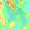
Smithfield topographic maps

Click on a map to view its topography, its elevation and its terrain.

Smithfield

United States > Maine > Somerset County > Smithfield

Average elevation: 105 m

Gear up for your next adventure:

🧭GPS Handheld Device - Reliable GPS navigation for outdoor adventures
💡Solar Camping Lamp - Eco-friendly lighting for campsites
🔋Emergency Crank Radio - Weather alerts and power without needing batteries
🧥Waterproof Pants - Keep dry during rainy hiking conditions
🧴Bear Spray Holster - Quick-access carry for essential Canadian wilderness safety

As an Amazon Associate, this site earns from qualifying purchases at no extra cost to you.