Geolocate

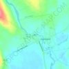
Harmony topographic map

Click on the map to display elevation.

About this map
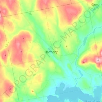
Name: Harmony topographic map, elevation, terrain.

Location: Harmony, Somerset County, Maine, 04942, United States (44.92137 -69.62097 45.02833 -69.46766)

Average elevation: 146 m

Minimum elevation: 69 m

Maximum elevation: 272 m

Other topographic maps

Click on a map to view its topography, its elevation and its terrain.

Pratt Hill

United States > Maine > Somerset County > Skowhegan

Average elevation: 113 m

Bigelow Hill

United States > Maine > Somerset County > Skowhegan

Average elevation: 158 m

Mackamp

United States > Maine > Somerset County

Average elevation: 395 m

Gray Island

United States > Maine > Somerset County > Solon

Average elevation: 105 m

Norris Brook

United States > Maine > Somerset County

Average elevation: 420 m

Gear up for your next adventure:

🛶Kayak Dry Bag - Waterproof storage for kayaking adventures
🧤Insulated Winter Gloves - Heavy-duty protection for sub-zero Canadian adventures
🧥Waterproof Jacket - Lightweight rain jackets for hiking and outdoor activities
☕Camping Coffee Maker - Brew fresh coffee anywhere on the topographic map
🚲Handlebar Phone Mount - View topographic-map.com live while cycling

As an Amazon Associate, this site earns from qualifying purchases at no extra cost to you.