Geolocate

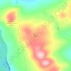
Cambridge topographic map

Click on the map to display elevation.

About this map

Name: Cambridge topographic map, elevation, terrain.

Location: Cambridge, Somerset County, Maine, 04923, United States (44.99418 -69.51860 45.07348 -69.35385)

Average elevation: 171 m

Minimum elevation: 86 m

Maximum elevation: 323 m

Other topographic maps

Click on a map to view its topography, its elevation and its terrain.
Pratt Hill

United States > Maine > Somerset County > Skowhegan

Average elevation: 113 m

Bigelow Hill

United States > Maine > Somerset County > Skowhegan

Average elevation: 158 m

Mackamp

United States > Maine > Somerset County

Average elevation: 395 m

Gray Island

United States > Maine > Somerset County > Solon

Average elevation: 105 m

Norris Brook

United States > Maine > Somerset County

Average elevation: 420 m

Gear up for your next adventure:

🚲Heavy Duty Bike Lock - Secure your bike at the trailhead or during stops
🎒Hiking Daypack - Lightweight and durable backpacks for day trips and excursions
🏕️Camping Hammock - Integrated protection for sleeping between trees
🛶Kayak Accessories - Essential gear for safe and fun kayaking adventures
🧦Crew Hiking Socks - Comfortable socks for long-distance hikes

As an Amazon Associate, this site earns from qualifying purchases at no extra cost to you.