Geolocate

Smithfield topographic map

Click on the map to display elevation.

About this map
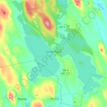
Name: Smithfield topographic map, elevation, terrain.

Location: Smithfield, Somerset County, Maine, 04978, United States (44.57734 -69.86882 44.67873 -69.74428)

Average elevation: 105 m

Minimum elevation: 62 m

Maximum elevation: 226 m

Gear up for your next adventure:

🦶Anti-Blister Balm - Prevents friction and hotspots during long ascents
💡Portable Camping Lamp - Rechargeable lamp for campsite lighting
🥾Trail Hiking Boots - Supportive boots for rough trails
📷Outdoor Action Camera - Capture high-elevation views and rugged adventures
🩹Moleskin Blister Pads - Direct protection for painful foot pressure points

As an Amazon Associate, this site earns from qualifying purchases at no extra cost to you.