Geolocate

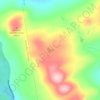
Jackman topographic map

Click on the map to display elevation.

About this map
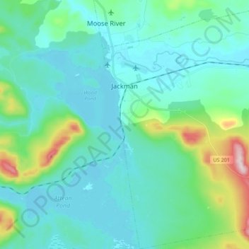
Name: Jackman topographic map, elevation, terrain.

Location: Jackman, Somerset County, Maine, 04945, United States (45.54726 -70.26868 45.66366 -70.11773)

Average elevation: 413 m

Minimum elevation: 348 m

Maximum elevation: 733 m

Other topographic maps

Click on a map to view its topography, its elevation and its terrain.
Pratt Hill

United States > Maine > Somerset County > Skowhegan

Average elevation: 113 m

Bigelow Hill

United States > Maine > Somerset County > Skowhegan

Average elevation: 158 m

Mackamp

United States > Maine > Somerset County

Average elevation: 395 m

Gray Island

United States > Maine > Somerset County > Solon

Average elevation: 105 m

Norris Brook

United States > Maine > Somerset County

Average elevation: 420 m

Gear up for your next adventure:

🩹Moleskin Blister Pads - Direct protection for painful foot pressure points
🧴First Aid Kit - Essential first aid supplies for outdoor emergencies
🛶Kayak Dry Bag - Waterproof storage for kayaking adventures
⛺Backpacking Tent - Lightweight tent for long-distance hiking trips
🧭Orienteering Kit - Tools for map reading and navigation in the wild

As an Amazon Associate, this site earns from qualifying purchases at no extra cost to you.