Geolocate

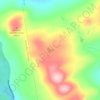
Ripley topographic map

Click on the map to display elevation.

About this map

Name: Ripley topographic map, elevation, terrain.

Location: Ripley, Somerset County, Maine, United States (44.96824 -69.48234 45.06715 -69.33095)

Average elevation: 147 m

Minimum elevation: 80 m

Maximum elevation: 252 m

Other topographic maps

Click on a map to view its topography, its elevation and its terrain.
Pratt Hill

United States > Maine > Somerset County > Skowhegan

Average elevation: 113 m

Bigelow Hill

United States > Maine > Somerset County > Skowhegan

Average elevation: 158 m

Mackamp

United States > Maine > Somerset County

Average elevation: 395 m

Gray Island

United States > Maine > Somerset County > Solon

Average elevation: 105 m

Norris Brook

United States > Maine > Somerset County

Average elevation: 420 m

Gear up for your next adventure:

🧦Crew Hiking Socks - Comfortable socks for long-distance hikes
💧Collapsible Water Bottle - Space-saving water bottle for outdoor activities
🥾Trail Running Boots - Durable shoes designed for trail running
⛺Tent Footprint - Protect tent floor and increase durability
🧣Evaporative Cooling Towel - Beat the heat during intense summer climbs

As an Amazon Associate, this site earns from qualifying purchases at no extra cost to you.