
Baldy Mountain topographic map
Interactive map
Click on the map to display elevation.
About this map
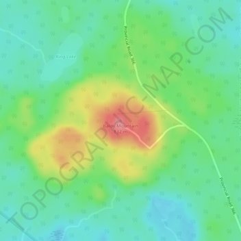
Name: Baldy Mountain topographic map, elevation, terrain.
Location: Baldy Mountain, Manitoba, Canada (51.47019 -100.72053 51.47029 -100.72043)
Average elevation: 772 m
Minimum elevation: 741 m
Maximum elevation: 834 m
Manitoba trails, hiking, mountain biking, running and outdoor activities
Other topographic maps
Click on a map to view its topography, its elevation and its terrain.
Winnipeg
Winnipeg lies at the bottom of the Red River Valley, a flood plain with an extremely flat topography. It is on the eastern edge of the Canadian Prairies in Western Canada and is known as the "Gateway to the West". Winnipeg is bordered by tallgrass prairie to the west and south and the aspen parkland to the…
Average elevation: 236 m
Riding Mountain National Park
The climate in the Riding Mountain region is similar to that of other regions of southwestern Manitoba. Under the Köppen classification it has a continental climate. It includes grasslands, upland boreal and eastern deciduous forest ecosystems. The park has hot summers and cold winters, with annual rainfall…
Average elevation: 488 m
Winnipeg
Winnipeg lies at the bottom of the Red River Valley, a flood plain with an extremely flat topography. It is on the eastern edge of the Canadian Prairies in Western Canada and is known as the "Gateway to the West". Winnipeg is bordered by tallgrass prairie to the west and south and the aspen parkland to the…
Average elevation: 236 m
West Shoal Lake
Canada > Manitoba > Division No. 18 > Rural Municipality of St. Laurent
Average elevation: 262 m
Winnipeg
Winnipeg lies at the bottom of the Red River Valley, a flood plain with an extremely flat topography. It is on the eastern edge of the Canadian Prairies in Western Canada and is known as the "Gateway to the West". Winnipeg is bordered by tallgrass prairie to the west and south and the aspen parkland to the…
Average elevation: 236 m
Swan Lake
Canada > Manitoba > Unorganized Division No. 19
The Swan Lake drainage basin covers 3,880 square miles (10,000 km2) and extends into the province of Saskatchewan. It is located between the Duck Mountains and the Porcupine Hills. Two major rivers discharge into Swan Lake from the basin, the Swan River and the Woody River. Other topographic features include…
Average elevation: 269 m
Stonewall
When the last ice age retreated, as well as the prairies, escarpments such as Riding Mountain were left behind. In addition to these, smaller elevations were left behind such as Stony Mountain and Stonewall. It is believed that these escarpments were used as look-outs by early hunters approximately 4,000 to…
Average elevation: 251 m
West Hawk Lake
Canada > Manitoba > Unorganized Division No. 1 > West Hawk Lake
Average elevation: 344 m
North Thomas Lake
Canada > Manitoba > Division No. 15 > Rural Municipality of Yellowhead
Average elevation: 596 m
Hecla/Grindstone Provincial Park
Canada > Manitoba > Unorganized Division No. 18 (East)
Average elevation: 220 m
Bridal Lake
Canada > Manitoba > Division No. 23 > Unorganized Division No. 23
Average elevation: 312 m
Charleswood--St. James--Assiniboia--Headingley
Canada > Manitoba > Division No. 11 > Winnipeg
Average elevation: 238 m
Duck Mountain Provincial Park
Canada > Manitoba > Unorganized Division No. 20 (South)
Average elevation: 656 m
Rowland Lake
Canada > Manitoba > Division No. 15 > Rural Municipality of Rosedale
Average elevation: 692 m
Winnipeg
Winnipeg lies at the bottom of the Red River Valley, a flood plain with an extremely flat topography. It is on the eastern edge of the Canadian Prairies in Western Canada and is known as the "Gateway to the West". Winnipeg is bordered by tallgrass prairie to the west and south and the aspen parkland to the…
Average elevation: 236 m
Laurie River;Tod Lake
Canada > Manitoba > Division No. 23 > Unorganized Division No. 23
Average elevation: 362 m
Clear Lake
Canada > Manitoba > Division No. 18 > Rural Municipality of Grahamdale
Average elevation: 251 m
Red River Floodway
Canada > Manitoba > Rural Municipality of Springfield > Winnipeg
Average elevation: 236 m