
Tambo Island topographic map
Interactive map
Click on the map to display elevation.
About this map
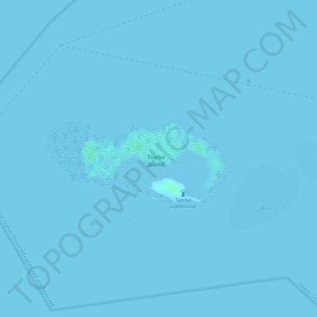
Name: Tambo Island topographic map, elevation, terrain.
Location: Tambo Island, Bohol, Central Visayas, Philippines (10.18822 124.27343 10.19510 124.28611)
Average elevation: 0 m
Minimum elevation: -1 m
Maximum elevation: 4 m
Other topographic maps
Click on a map to view its topography, its elevation and its terrain.
Aguipo
Philippines > Bohol > Mabini
Aguipo, Mabini, Bohol, Central Visayas, Philippines
Average elevation: 57 m
Sagbayan
Sagbayan, Bohol, Central Visayas, 6331, Philippines
Average elevation: 248 m
Ipil
Philippines > Bohol > Bunga Mar
Ipil, Bunga Mar, Bohol, Central Visayas, 6308, Philippines
Average elevation: 51 m
Cabantian
Philippines > Bohol > Guindulman
Cabantian, Guindulman, Bohol, Central Visayas, Philippines
Average elevation: 52 m
Bogo
Philippines > Bohol > Carlos P. Garcia
Bogo, Carlos P. Garcia, Bohol, Central Visayas, 6334, Philippines
Average elevation: 25 m
Lobogon
Lobogon, Bohol, Central Visayas, 6309, Philippines
Average elevation: 151 m
Mount Matunog
Mount Matunog, Bohol, Central Visayas, Philippines
Average elevation: 696 m
Quinoguitan
Quinoguitan, Bohol, Central Visayas, 6316, Philippines
Average elevation: 120 m
Tubod Monte
Philippines > Bohol > Jagna
Tubod Monte, Jagna, Bohol, Central Visayas, 6308, Philippines
Average elevation: 46 m
Doljo Beach
Philippines > Bohol > Panglao
Doljo Beach, Doljo, Panglao, Bohol, Central Visayas, 6340, Philippines
Average elevation: 1 m
Libaong
Philippines > Bohol > Panglao
Libaong, Panglao, Bohol, Central Visayas, 6340, Philippines
Average elevation: 23 m
Cambacay
Philippines > Bohol > Batuan
Cambacay, Batuan, Bohol, Central Visayas, 6318, Philippines
Average elevation: 279 m
Camisan
Philippines > Bohol > Loboc
Camisan, Loboc, Bohol, Central Visayas, 6316, Philippines
Average elevation: 101 m
Lungsoda-an
Philippines > Bohol > Candijay
Lungsoda-an, Candijay, Bohol, Central Visayas, Philippines
Average elevation: 24 m
Anoling
Philippines > Bohol > Candijay
Anoling, Candijay, Bohol, Central Visayas, Philippines
Average elevation: 79 m
Poblacion
Philippines > Bohol > Anda
Poblacion, Anda, Bohol, Central Visayas, Philippines
Average elevation: 7 m
Canlasid
Canlasid, Bohol, Central Visayas, 6316, Philippines
Average elevation: 37 m
Alona Beach
Philippines > Bohol > Panglao > Tawala
Alona Beach, Tawala, Panglao, Bohol, Central Visayas, 6340, Philippines
Average elevation: 6 m
Dumaluan
Philippines > Bohol > Panglao > Libaong
Dumaluan, Regla, Libaong, Panglao, Bohol, Central Visayas, 6340, Philippines
Average elevation: 10 m
Dauis
Dauis, Bohol, Central Visayas, 6339, Philippines, Panglao
Average elevation: 10 m
Tawala
Philippines > Bohol > Panglao
Tawala, Panglao, Bohol, Central Visayas, 6340, Philippines
Average elevation: 17 m
Maribojoc
Maribojoc, Bohol, Central Visayas, 6336, Philippines
Average elevation: 68 m
Camanbugan
Camanbugan, Bohol, Central Visayas, 6315, Philippines
Average elevation: 9 m
Tawid
Philippines > Bohol > Anda
Tawid, Anda, Bohol, Central Visayas, Philippines
Average elevation: 55 m
San Vicente
Philippines > Bohol > Carlos P. Garcia
San Vicente, Carlos P. Garcia, Bohol, Central Visayas, 6346, Philippines
Average elevation: 13 m
Panglao Island
Panglao Island, Dauis, Bohol, Central Visayas, 6339, Philippines
Average elevation: 47 m
Lagtangon
Lagtangon, Bohol, Central Visayas, 6336, Philippines
Average elevation: 105 m
Estacahan
Philippines > Bohol > Tomoc
Estacahan, Tomoc, Bohol, Central Visayas, Philippines
Average elevation: 130 m
Banlasan
Banlasan, Bohol, Central Visayas, 6345, Philippines
Average elevation: 129 m
Banlasan
Banlasan, Bohol, Central Visayas, 6345, Philippines
Average elevation: 189 m
Loboc River
Philippines > Bohol > Tagbilaran
Loboc River, Tagbilaran, Bohol, Central Visayas, Philippines
Average elevation: 199 m
Pangangan Island
Philippines > Bohol > Calape
Pangangan Island, Calape, Bohol, Central Visayas, Philippines
Average elevation: 1 m
Loboc River
Philippines > Bohol > Loboc > Camisan
Loboc River, Camisan, Loboc, Bohol, Central Visayas, 6316, Philippines
Average elevation: 70 m
Sevilla
Philippines > Bohol > Sevilla
Sevilla, Bohol, Central Visayas, Philippines
Average elevation: 158 m
Chocolate Hills
Philippines > Bohol > Buenos Aires
Chocolate Hills, Buenos Aires, Bohol, Central Visayas, 6318, Philippines
Average elevation: 315 m
San Roque
Philippines > Bohol > Mabini > San Roque
San Roque, Mabini, Bohol, Central Visayas, Philippines
Average elevation: 46 m
Panglao
Philippines > Bohol > Panglao
Panglao, Bohol, Central Visayas, 6340, Philippines
Average elevation: 4 m