Geolocate

Cambacay topographic map

Click on the map to display elevation.

About this map

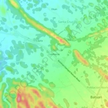
Name: Cambacay topographic map, elevation, terrain.

Location: Cambacay, Batuan, Bohol, Central Visayas, 6318, Philippines (9.78000 124.11333 9.82000 124.15333)

Average elevation: 279 m

Minimum elevation: 239 m

Maximum elevation: 366 m

Gear up for your next adventure:

🚲Heavy Duty Bike Lock - Secure your bike at the trailhead or during stops
🧭GPS Tracker - Track your location in remote areas safely
🦟Insect Repellent - Keep mosquitoes and black flies away in wooded areas
🛏️Sleeping Bag - Warm and compact sleeping bags for outdoor camping
🧥Thermal Fleece Jacket - Versatile insulation for changing mountain temperatures

As an Amazon Associate, this site earns from qualifying purchases at no extra cost to you.