
Ondol topographic map
Click on the map to display elevation.
About this map
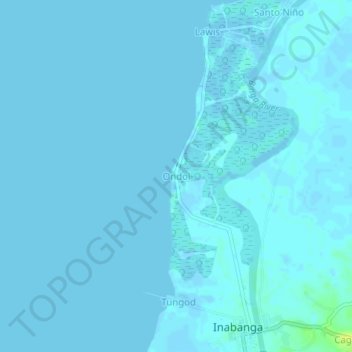
Name: Ondol topographic map, elevation, terrain.
Location: Ondol, Bohol, Central Visayas, Philippines (10.02906 124.03904 10.06906 124.07904)
Average elevation: 1 m
Minimum elevation: -5 m
Maximum elevation: 17 m
Other topographic maps
Click on a map to view its topography, its elevation and its terrain.