
Banlasan topographic map
Click on the map to display elevation.
About this map
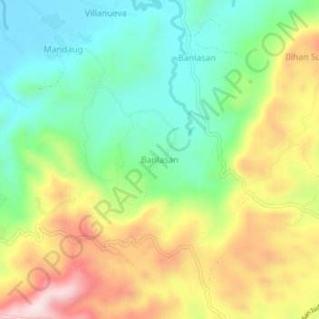
Name: Banlasan topographic map, elevation, terrain.
Location: Banlasan, Bohol, Central Visayas, 6345, Philippines (9.86944 123.91842 9.90944 123.95842)
Average elevation: 189 m
Minimum elevation: 9 m
Maximum elevation: 457 m
Other topographic maps
Click on a map to view its topography, its elevation and its terrain.