Geolocate

Ipil topographic map

Click on the map to display elevation.

About this map

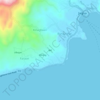
Name: Ipil topographic map, elevation, terrain.

Location: Ipil, Bunga Mar, Bohol, Central Visayas, 6308, Philippines (9.61528 124.33306 9.65528 124.37306)

Average elevation: 51 m

Minimum elevation: -1 m

Maximum elevation: 468 m

Gear up for your next adventure:

🧭GPS Handheld Device - Reliable GPS navigation for outdoor adventures
🩹Compact First Aid Kit - Pre-packed essentials for common trail injuries
🧥Waterproof Pants - Keep dry during rainy hiking conditions
Lightweight Backpacking Tent - Compact tent for efficient hiking trips
🛶Kayak Dry Bag - Waterproof storage for kayaking adventures

As an Amazon Associate, this site earns from qualifying purchases at no extra cost to you.