Geolocate

Loboc River topographic map

Click on the map to display elevation.

About this map

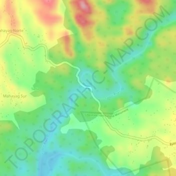
Name: Loboc River topographic map, elevation, terrain.

Location: Loboc River, Tagbilaran, Bohol, Central Visayas, Philippines (9.81676 124.07491 9.81683 124.07492)

Average elevation: 199 m

Minimum elevation: 129 m

Maximum elevation: 289 m

Gear up for your next adventure:

🥫Freeze-Dried Meals - Lightweight, high-calorie nutrition for multi-day treks
🦌Outdoor Trail Camera - Monitor wildlife activity near your favorite spots
🧥Thermal Layer - Insulating layer for cold outdoor conditions
🩹Moleskin Blister Pads - Direct protection for painful foot pressure points
🧥Ultralight Puffy Jacket - Maximum warmth that packs down to the size of an orange

As an Amazon Associate, this site earns from qualifying purchases at no extra cost to you.