Geolocate

Tawala topographic map

Click on the map to display elevation.

About this map

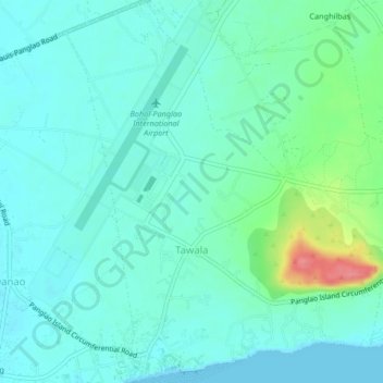
Name: Tawala topographic map, elevation, terrain.

Location: Tawala, Panglao, Bohol, Central Visayas, 6340, Philippines (9.54772 123.76354 9.58862 123.79781)

Average elevation: 17 m

Minimum elevation: 0 m

Maximum elevation: 81 m

Other topographic maps

Click on a map to view its topography, its elevation and its terrain.

Panglao

Philippines > Bohol > Panglao

Average elevation: 4 m

Daorong

Philippines > Bohol > Panglao > Danao

Average elevation: 3 m

Gear up for your next adventure:

🧳Compression Sacks - Maximize space in your backpack by shrinking gear
🥾Lightweight Hiking Shoes - Comfortable shoes for day hikes
👟Leg Gaiters - Keep debris, mud, and snow out of your boots
🗺️Topographic Maps - Detailed maps to explore trails, mountains, and wilderness areas
🎒Hiking Daypack - Lightweight and durable backpacks for day trips and excursions

As an Amazon Associate, this site earns from qualifying purchases at no extra cost to you.