
Ugpong topographic map
Click on the map to display elevation.
About this map
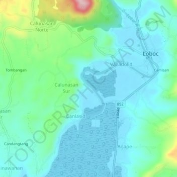
Name: Ugpong topographic map, elevation, terrain.
Location: Ugpong, Bohol, Central Visayas, 6316, Philippines (9.60914 123.99668 9.64914 124.03668)
Average elevation: 49 m
Minimum elevation: -2 m
Maximum elevation: 242 m
Other topographic maps
Click on a map to view its topography, its elevation and its terrain.