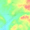
Monroe County topographic map
Click on the map to display elevation.
About this map

Name: Monroe County topographic map, elevation, terrain.
Location: Monroe County, Arkansas, United States (34.33623 -91.44789 35.00426 -91.00027)
Average elevation: 58 m
Minimum elevation: 40 m
Maximum elevation: 76 m
Other topographic maps
Click on a map to view its topography, its elevation and its terrain.
Eureka Springs
United States > Arkansas > Carroll County > Eureka Springs
It is a tourist destination for its unique character as a Victorian resort village. The city has steep winding streets filled with Victorian-style cottages and manors. The historic commercial downtown of the city has an extensive streetscape of well-preserved Victorian buildings. The buildings are primarily…
Average elevation: 417 m
Crater of Diamonds State Park
United States > Arkansas > Pike County > Murfreesboro > Kimberley
Average elevation: 106 m



Quail Valley
United States > Arkansas > Independence County > Batesville > Quail Valley
Average elevation: 110 m


Petit Jean River State Wildlife Management Area
United States > Arkansas > Yell County
Average elevation: 96 m












Hot Springs National Park
United States > Arkansas > Garland County > Hot Springs
The National Park Service exercises no control or supervision over any matters connected with the city. The city starts on the other side of Central Avenue from Bathhouse Row. Its development has extended beyond the narrow valley in which the springs are located, spreading out over the open plain to the south…
Average elevation: 227 m