
Little Rock topographic map
Click on the map to display elevation.
About this map
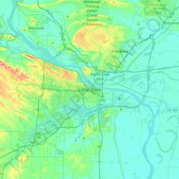
Name: Little Rock topographic map, elevation, terrain.
Location: Little Rock, Pulaski County, Arkansas, 72201, United States (34.58648 -92.44959 34.90648 -92.12959)
Average elevation: 98 m
Minimum elevation: 63 m
Maximum elevation: 275 m
Other topographic maps
Click on a map to view its topography, its elevation and its terrain.