Geolocate

Bexar topographic map

Click on the map to display elevation.

About this map

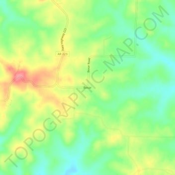
Name: Bexar topographic map, elevation, terrain.

Location: Bexar, Fulton County, Arkansas, 72515, United States (36.26673 -92.01571 36.30673 -91.97571)

Average elevation: 265 m

Minimum elevation: 227 m

Maximum elevation: 315 m

Gear up for your next adventure:

💡Portable Camping Lamp - Rechargeable lamp for campsite lighting
🛶Waterproof Dry Bags - Keep electronics and clothes dry during river crossings
🥾Light Hiking Boots - Lightweight and comfortable boots for day hikes
🧢Outdoor Visor - Breathable visor for sunny hikes
🔪Outdoor Multitool - Versatile tool for repairs and food prep in the wild

As an Amazon Associate, this site earns from qualifying purchases at no extra cost to you.