Bulgaria topographic maps
Click on a map to view its topography, its elevation and its terrain.

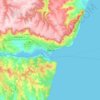

Rhodope Mountains
In geomorphological terms, the Rhodopes are part of the Rila-Rhodope massif, which is the oldest landmass on the Balkan peninsula. The Rhodopes are spread over 14,735 square kilometers (5,689 sq mi), of which 12,233 square kilometers (4,723 sq mi) are on Bulgarian territory. They have the greatest extent of…
Average elevation: 501 m


Bansko
Bansko lies at the foot of the Pirin Mountains, not far from the national park of the same name, in the valley of the Nestos River at an elevation of 925 meters above sea level. It is a ski resort. The city is about 160 km from Sofia and about 220 km from Thessaloniki.
Average elevation: 1,597 m


Sredna Gora
Bulgaria > Sofia > Koprivshtitsa
The mountain is divided into three parts by the rivers Topolnitsa and Stryama — Ihtimanska Sredna Gora to the west, Sashtinska Sredna Gora in the center, and Sarnena Sredna Gora to the east. Compared to most other mountain ranges in Bulgaria, Sredna Gora has lower average altitude, which determines higher…
Average elevation: 1,300 m




Iskar
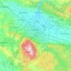
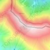
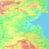
The Iskar headwaters consist of three forks in the northern slopes of Rila, Bulgaria's highest mountain range. The 23 km long Cherni (black) Iskar is considered the main stem of the river. It takes its source from the Chamovsko Lake (2,500 m) to the north-east of the summit of Damga (2,669 m) and from there…
Average elevation: 576 m


Yantra
The Yantra (/ˈjæntrə/ YAN-trə; Bulgarian: Янтра, romanized: Jantra, IPA: [ˈjantrɐ]) is a river in northern Bulgaria, a right tributary of the Danube. Reaching a length of 285 km, it is the seventh longest river in Bulgaria and the third longest Bulgarian tributary of the Danube. In the middle and…
Average elevation: 302 m




Borovets
Borovets (Bulgarian: Боровец [ˈbɔrovɛt͡s]), known as Chamkoria (Чамкория [ˈt͡ʃam koˈrijɐ]) until the middle of the 20th century, is a popular Bulgarian mountain resort situated in Sofia Province, on the northern slopes of Rila mountain, at an elevation of 1350 m.
Average elevation: 1,394 m

Rila mountain range
Rila (Bulgarian: Рила, pronounced [ˈriɫɐ]) is the highest mountain range of Bulgaria, the Balkan Peninsula, and Southeast Europe. It is situated in southwestern Bulgaria and forms part of the Rila–Rhodope Massif. The highest summit is Musala at an elevation of 2,925 m which makes Rila the sixth…
Average elevation: 2,525 m


Gorno Kraishte
The terrain is mountainous and hilly, covering parts of Western Rila and Rhodope Mountains and the valley in the upper reaches of the Mesta River. The average altitude is 850 meters. The climate is transitional continental with an average annual temperature is 8 °C. Winters are cold, with an average January…
Average elevation: 866 m




Elhovo
Central to this region is the field of Elhovo. Its flat surface extends on both sides of the river Tundzha which is flowing from the north. The average elevation is 100–150 m. In the peripheral parts the field gradually passes into the gentle slopes of the Manastira and the Dervent Heights.
Average elevation: 121 m



Vihren
Vihren (Bulgarian: Вихрен [ˈvixrɛn]) is the highest peak of Bulgaria's Pirin Mountains. Reaching 2,914 metres (9,560 ft), it is Bulgaria's second and the Balkans' third highest, after Musala and Mount Olympus. Although Vihren is deprived of lakes and streams due to the karst topography, a number of…
Average elevation: 2,442 m


Kyustendil
Kyustendil is a national balneological resort at an altitude of 600 metres. There are more than 40 mineral springs in the town. The waters have a high content of sulfite compounds. These are used for the treatment of the locomotory system, gynecological and other kinds of diseases. The resort region includes…
Average elevation: 937 m


Belmeken
Belmeken (Bulgarian: Белмекен) is a summit in the northeastern part of the Rila Mountain in southwestern Bulgaria with a height of 2,626 m. It is built up of granite. Its northern slopes are steep and rise over the Kutlinite cirque. The southern and southeastern slopes are oblique. To the southeast at…
Average elevation: 2,300 m

Rhodope Mountains
In geomorphological terms, the Rhodopes are part of the Rila-Rhodope massif, which is the oldest landmass on the Balkan peninsula. The Rhodopes are spread over 14,735 square kilometers (5,689 sq mi), of which 12,233 square kilometers (4,723 sq mi) are on Bulgarian territory. They have the greatest extent of…
Average elevation: 441 m


Kazanlak
The Bulgarian climate is temperate, with average temperatures from 0 °C (32 °F) to 1.5 °C (34.7 °F) in January, and 21 °C (70 °F) in July. The average altitude is 350 m (1,150 ft).
Average elevation: 378 m

Vitosha
Due to a great variability in elevation, a rich diversity of climates, flora and fauna can be found within the park. Research has revealed that on the comparatively small area of the mountain there are 1,500 species of higher plants, 500 species of fungi, 500 species of algae, 326 species of mosses, and 200…
Average elevation: 2,105 m
Pazardzhik
The northern parts of the region include the middle ridges of the Sredna Gora mountain, to the south the relief flattens and forms the westernmost parts of the Upper Thracian Plain and to the south are located the Rhodope Mountains where most of the forests are situated. The highest point of the region is…
Average elevation: 931 m

Ruse
Ruse is on the right bank of the river Danube, which is the high bank, having two underwater terraces and three river terraces at 15 to 22 m (49.21–72.18 ft), 30 to 66 m (98.43–216.54 ft), and 54 to 65 m (177.17–213.25 ft). The average altitude is 45.5 m (149.28 ft) AMSL. The urban area is an…
Average elevation: 62 m