Geolocate

Ruen topographic map

Click on the map to display elevation.

About this map

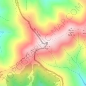
Name: Ruen topographic map, elevation, terrain.

Location: Ruen, Kyustendil, Bulgaria (42.15796 22.51622 42.15806 22.51632)

Average elevation: 1,982 m

Minimum elevation: 1,648 m

Maximum elevation: 2,251 m

Gear up for your next adventure:

🧥Waterproof Pants - Keep dry during rainy hiking conditions
🧦Outdoor Socks - Durable socks designed for hiking and outdoor sports
🛶Canoe Life Vest - Safety vest for water sports
❄️Traction Ice Cleats - Slip-on spikes for icy trails and winter hiking
🧦Hiking Socks - Moisture-wicking and comfortable socks for long hikes

As an Amazon Associate, this site earns from qualifying purchases at no extra cost to you.