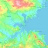
Aytos topographic map
Click on the map to display elevation.
About this map

Name: Aytos topographic map, elevation, terrain.
Location: Aytos, Aitos, Burgas, 8500, Bulgaria (42.66189 27.21204 42.74189 27.29204)
Average elevation: 149 m
Minimum elevation: 59 m
Maximum elevation: 437 m
Other topographic maps
Click on a map to view its topography, its elevation and its terrain.

Veleka
The Veleka takes its source at an altitude of 664 m from several karst springs in the Turkish part of the Strandzha (İstranca) mountain range some 3 km southwest of the Turkish village of Ahlatlı and 5 km southeast of the Bulgarian village of Belevren. It flows in a deep forested valley, forming a large arc…
Average elevation: 301 m