Geolocate

Yakoruda topographic map

Click on the map to display elevation.

About this map

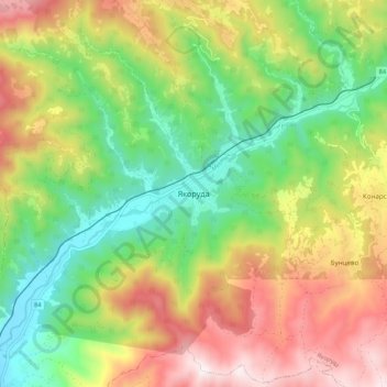
Name: Yakoruda topographic map, elevation, terrain.

Location: Yakoruda, Blagoevgrad, 2790, Bulgaria (41.97729 23.62778 42.05729 23.70778)

Average elevation: 1,191 m

Minimum elevation: 825 m

Maximum elevation: 1,681 m

Gear up for your next adventure:

👖Convertible Hiking Pants - Zip-off legs to adapt to changing weather conditions
🍽️Titanium Camping Spork - Ultralight and indestructible eating utensil
💧Reusable Water Bottle - Durable water bottles for hydration on trails
🥾Mountain Trail Shoes - High-traction shoes for mountain trails
🧦Hiking Liner Socks - Thin base layer to prevent friction and blisters

As an Amazon Associate, this site earns from qualifying purchases at no extra cost to you.