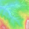
Santurce topographic map
Click on the map to display elevation.
About this map
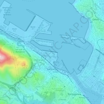
Name: Santurce topographic map, elevation, terrain.
Location: Santurce, Vizcaya, País Vasco, 48980, España (43.31529 -3.07114 43.35538 -3.02287)
Average elevation: 34 m
Minimum elevation: -3 m
Maximum elevation: 360 m
Other topographic maps
Click on a map to view its topography, its elevation and its terrain.
Hondarribia
España > País Vasco > Bajo Bidasoa > Hondarribia
Hacia el sudoeste el término municipal de Fuenterrabía se prolonga por una zona de colinas bajas de escasa altitud que están drenadas por pequeños afluentes del Bidasoa, entre los que destaca la regata de Jaizubia.
Average elevation: 34 m

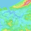
Rentería
El término municipal se extiende desde una zona montañosa al sur, que incluye parte del parque natural Aiako Arria, el monte Urdaburu y el curso alto del río Urumea, que hace de límite con Navarra e incluye el embalse de Añarbe que represa las aguas del río Añarbe antes de su desembocadura en el Urumea.…
Average elevation: 95 m
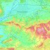
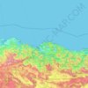
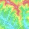


Anboto
España > País Vasco > Atxondo
El Amboto (en euskera: Anboto) es uno de los montes vascos más conocidos, situado entre Vizcaya y Álava en el País Vasco (España) y de 1331 metros de altitud. Es uno de los montes más conocidos de los Montes Vascos por su importancia en la mitología vasca. El Amboto es la morada principal de la diosa…
Average elevation: 779 m
Llodio
España > País Vasco > Ayala
El municipio de Llodio, que tiene una superficie de 37,45 km² y una altitud de unos 130 metros sobre el nivel del mar, está situado al noroeste de Álava, en el límite con la provincia de Vizcaya. Se encuentra enmarcado en el Valle de Ayala y cuenta con una población cercana a los 18 000 habitantes, lo que…
Average elevation: 305 m
Gorbeia
España > País Vasco > Estribaciones del Gorbea > Ceánuri
El monte Gorbea (en euskera: Gorbeia) es la cumbre más alta del macizo montañoso del mismo nombre, situado en los Montes Vascos, a caballo entre las provincias de Álava y Vizcaya, en el País Vasco (España). Tiene una altitud de 1482 metros sobre el nivel del mar y su cima está coronada desde 1899 por una…
Average elevation: 1,189 m
Aizkorri
España > País Vasco > Cegama
El Aizkorri o Aitzgorri es una montaña de 1528 metros de altitud perteneciente a la sierra de Aizkorri en los Montes Vascos. Está situado en Guipúzcoa, País Vasco, España.
Average elevation: 1,117 m









San Sebastián
España > País Vasco > Comarca de San Sebastián > San Sebastián
San Sebastián se asienta a orillas del mar Cantábrico, y tiene varias playas (siendo la más conocida la de La Concha, en la bahía homónima) y un pequeño puerto al abrigo del monte Urgull. Posee además otras montañas, tanto promontorios costeros como tierra adentro, estando su cima más alta, Urdaburu…
Average elevation: 134 m
Valle de Trápaga
España > País Vasco > Andraka > Valle de Trápaga > Valle de Trápaga
Average elevation: 164 m

Oñate
España > País Vasco > Alto Deva > Oñate
Oñate fue una villa señorial poderosa que pasó a ser condado. No se integró en la provincia de Guipúzcoa hasta 1845. En su seno se fundó la primera universidad del País Vasco, la universidad de Oñate, en 1543. Es el municipio más extenso de la provincia y el núcleo urbano se encuentra a una altitud…
Average elevation: 488 m
Etxeberri
España > País Vasco > Comarca de San Sebastián > Hernani > Etxeberri
Average elevation: 61 m

Carral
España > País Vasco > Sopuerta > Mercadillo
San Martín de Carral, es uno de los seis barrios o parroquias del municipio de Sopuerta en la provincia de Vizcaya, País Vasco. Se encuentra entre los barrios de Avellaneda y Mercadillo. De acuerdo con el censo del 1 de enero de 2007, tiene una población de 168 personas ubicadas a una altitud media de…
Average elevation: 268 m