Geolocate

Urkiola topographic map

Click on the map to display elevation.

About this map

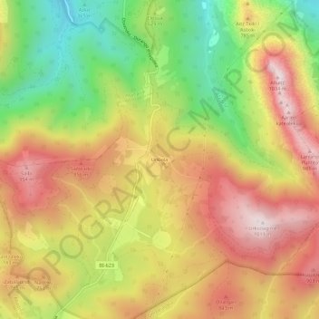
Name: Urkiola topographic map, elevation, terrain.

Location: Urkiola, Abadiano, Vizcaya, País Vasco, 48212, España (43.07977 -2.66424 43.11977 -2.62424)

Average elevation: 660 m

Minimum elevation: 267 m

Maximum elevation: 1,008 m

Gear up for your next adventure:

💡Portable Camping Lamp - Rechargeable lamp for campsite lighting
Camping Coffee Maker - Brew fresh coffee anywhere on the topographic map
💡LED Camping Lantern - Illuminate your campsite with long-lasting lanterns
🧢Sun Protection Cap - Breathable cap to protect from sun exposure
🧭GPS Outdoor Watch - Smart watch for navigation and fitness tracking in nature

As an Amazon Associate, this site earns from qualifying purchases at no extra cost to you.