Geolocate

Antzora topographic map

Click on the map to display elevation.

About this map

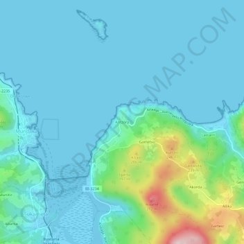
Name: Antzora topographic map, elevation, terrain.

Location: Antzora, Ibarrangelu, Vizcaya, País Vasco, 48360, España (43.38927 -2.69767 43.42927 -2.65767)

Average elevation: 51 m

Minimum elevation: -4 m

Maximum elevation: 333 m

Gear up for your next adventure:

💡Portable Camping Lamp - Rechargeable lamp for campsite lighting
Lightweight Camping Tent - Portable shelter optimized for Canadian backcountry camping
🥾Trail Hiking Socks - Comfortable socks to prevent blisters and fatigue
🧥Softshell Jacket - Windproof and breathable jacket for hiking
🛶Kayak Dry Bag - Waterproof storage for kayaking adventures

As an Amazon Associate, this site earns from qualifying purchases at no extra cost to you.