
Thank you for supporting this site ❤️
Make a donation
Make a donation
Gear up for your next adventure:
As an Amazon Associate, this site earns from qualifying purchases at no extra cost to you.
Jaizkibel topographic map
Click on the map to display elevation.
Thank you for supporting this site ❤️
Make a donation
Make a donation
Gear up for your next adventure:
As an Amazon Associate, this site earns from qualifying purchases at no extra cost to you.
About this map
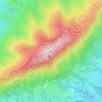
Name: Jaizkibel topographic map, elevation, terrain.
Location: Jaizkibel, Fuenterrabía, Guipúzcoa, País Vasco, 20100, España (43.34524 -1.85602 43.34534 -1.85592)
Average elevation: 252 m
Minimum elevation: 36 m
Maximum elevation: 539 m
Thank you for supporting this site ❤️
Make a donation
Make a donation
Gear up for your next adventure:
As an Amazon Associate, this site earns from qualifying purchases at no extra cost to you.