Geolocate

Artieta topographic map

Click on the map to display elevation.

About this map

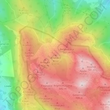
Name: Artieta topographic map, elevation, terrain.

Location: Artieta, Dima, Vizcaya, País Vasco, 48141, España (43.17782 -2.73664 43.17792 -2.73654)

Average elevation: 520 m

Minimum elevation: 195 m

Maximum elevation: 775 m

Other topographic maps

Click on a map to view its topography, its elevation and its terrain.

Lapurerreketa

España > País Vasco > Dima

Average elevation: 597 m

Gear up for your next adventure:

🥘Camping Cookware Set - Compact nesting pots and pans for trail cooking
Family Camping Tent - Spacious tent suitable for family camping trips
🚑Survival Whistle - Signal for help across long distances in mountains
🚲MTB Frame Bag - Carry tools and maps directly on your bicycle frame
🧊Insulated Water Bottle - Keeps drinks cold in summer and prevents freezing in winter

As an Amazon Associate, this site earns from qualifying purchases at no extra cost to you.