
Thank you for supporting this site ❤️
Make a donation
Make a donation
Gear up for your next adventure:
As an Amazon Associate, this site earns from qualifying purchases at no extra cost to you.
Artómaña topographic map
Click on the map to display elevation.
Thank you for supporting this site ❤️
Make a donation
Make a donation
Gear up for your next adventure:
As an Amazon Associate, this site earns from qualifying purchases at no extra cost to you.
About this map
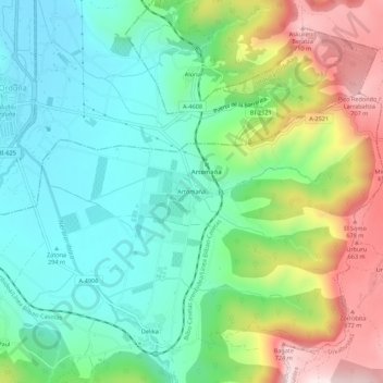
Name: Artómaña topographic map, elevation, terrain.
Location: Artómaña, Amurrio, Ayala, Álava, País Vasco, 01468, España (42.96405 -3.00220 43.00405 -2.96220)
Average elevation: 418 m
Minimum elevation: 263 m
Maximum elevation: 733 m
Thank you for supporting this site ❤️
Make a donation
Make a donation
Gear up for your next adventure:
As an Amazon Associate, this site earns from qualifying purchases at no extra cost to you.