
Thank you for supporting this site ❤️
Make a donation
Make a donation
Gear up for your next adventure:
As an Amazon Associate, this site earns from qualifying purchases at no extra cost to you.
Burnikurutz topographic map
Click on the map to display elevation.
Thank you for supporting this site ❤️
Make a donation
Make a donation
Gear up for your next adventure:
As an Amazon Associate, this site earns from qualifying purchases at no extra cost to you.
About this map
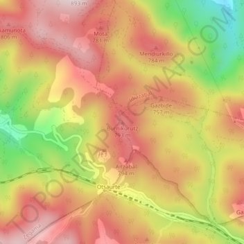
Name: Burnikurutz topographic map, elevation, terrain.
Location: Burnikurutz, Cegama, Guipúzcoa, País Vasco, 20215, España (42.94578 -2.25804 42.94588 -2.25794)
Average elevation: 676 m
Minimum elevation: 409 m
Maximum elevation: 851 m
Thank you for supporting this site ❤️
Make a donation
Make a donation
Gear up for your next adventure:
As an Amazon Associate, this site earns from qualifying purchases at no extra cost to you.