Tyrol topographic maps
Click on a map to view its topography, its elevation and its terrain.


Matrei am Brenner
Austria > Tyrol > Bezirk Innsbruck-Land
"Maria Waldrast" is a Sanctuary located in a side valley, at an altitude of 1638 meters under the Waldraster Jöchl. On April 19, 1409 the Prince Bishop of Brixen Ulrich II (Ulrich from Vienna) gave consent to the construction of the church, completed in 1429 and consecrated in 1465, the Sanctuary is part of…
Average elevation: 1,599 m

Gries
Austria > Tyrol > Bezirk Lienz > Prägraten am Großvenediger > Prägraten
Average elevation: 1,809 m

Bärenbad
Austria > Tyrol > Bezirk Innsbruck-Land > Neustift im Stubaital > Milders
Average elevation: 1,727 m


Grinzens
Austria > Tyrol > Bezirk Innsbruck-Land
Grinzens is a municipality in the Austrian state of Tyrol in the district of Innsbruck-Land. As of January 2015, its population is 1414. It lies southwest of the city of Innsbruck at an elevation of 945 m.
Average elevation: 1,692 m

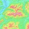
Wilder Kaiser
Austria > Tyrol > Bezirk Kufstein
The Kaiser Mountains are divided into the Wilder Kaiser or Wild Kaiser chain of mountains, formed predominantly of bare limestone rock, and the Zahmer Kaiser ("Tame Kaiser"), whose southern side is mainly covered by mountain pine. These two mountain ridges are linked by the 1,580-metre-high Stripsenjoch pass,…
Average elevation: 976 m
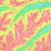


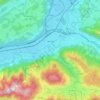
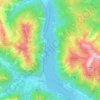


Gschnitz
Austria > Tyrol > Bezirk Innsbruck-Land
The Sanctuary of St. Magdalena is located near the border, between Gschnitz and Trins, at an altitude of 1,661 m (5,449 ft) accessible only on foot, under the Schönberg. The church is the oldest in the valley as confirmed by the Romanesque frescoes dating back around 1200 and discovered in 1959.
Average elevation: 2,017 m
Gerlos
Austria > Tyrol > Bezirk Schwaz
Gerlos is located in the de:Gerlostal, which is a side valley of the Zillertal, branching to the east near Zell am Ziller. Gerlos consists of several hamulated located along the de:Gerlospass on the floor of the valley, at an altitude of around 1200m. To the south, the side valleys of de:Schwarzach,…
Average elevation: 1,911 m
Nauders
Austria > Tyrol > Bezirk Landeck
The town lies in the valley of the Stillebach (a tributary of the Inn) in the Ötztal Alps, at an altitude of 1,394 m (4,573 ft). It is located about 29 km (18 mi) south of the district capital Landeck, on the road that leads from Pfunds in the Inntal valley via the narrow Finstermünz Gorge up to Reschen Pass…
Average elevation: 1,938 m
Sölden
Austria > Tyrol > Bezirk Imst
The main village of Sölden is at an elevation of 1,368 metres (4,488 ft) above sea level, and the upper village of Hochsölden at 2,090 m (6,857 ft) has 5 four-star hotels. The highest peak is the Wildspitze, at 3,768 m (12,362 ft), the second highest mountain in Austria, after the Großglockner.
Average elevation: 2,483 m
High Tauern National Park
The best-known mountain pass road of the High Tauern is the scenic Grossglockner High Alpine Road inaugurated in 1935, including a tunnel at an elevation of 2,505 metres (8,219 ft) under the Hochtor Pass (2,573 metres (8,442 ft)). East of it, the Katschberg Pass (1,641 metres (5,384 ft)) on B 99 Katschberg…
Average elevation: 1,710 m


Sankt Sigmund im Sellrain
Austria > Tyrol > Bezirk Innsbruck-Land
Sankt Sigmund im Sellrain is a municipality in western Austria, in the district of Innsbruck-Land in the state of Tyrol located 23.3 kilometres (14.5 mi) southeast of Innsbruck, in the deepest part of the Sellrain Valley. It has a large area and the highest elevation. The main source of income is winter…
Average elevation: 2,289 m