Geolocate

Gehörde topographic map

Click on the map to display elevation.

About this map

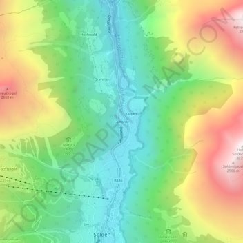
Name: Gehörde topographic map, elevation, terrain.

Location: Gehörde, Sölden, Bezirk Imst, Tyrol, 6450, Austria (46.96523 10.99201 47.00523 11.03201)

Average elevation: 1,914 m

Minimum elevation: 1,284 m

Maximum elevation: 2,948 m

Gear up for your next adventure:

Bushcraft Tarp - Versatile emergency shelter or gear protection
🧰Survival Kit - Essential gear for emergencies in the wilderness
🥾Mountain Hiking Boots - High-traction boots for rocky terrain
🧦Hiking Liner Socks - Thin base layer to prevent friction and blisters
🧥Waterproof Pants - Keep dry during rainy hiking conditions

As an Amazon Associate, this site earns from qualifying purchases at no extra cost to you.