
Thank you for supporting this site ❤️
Make a donation
Make a donation
Gear up for your next adventure:
As an Amazon Associate, this site earns from qualifying purchases at no extra cost to you.
Obertilliach topographic map
Click on the map to display elevation.
Thank you for supporting this site ❤️
Make a donation
Make a donation
Gear up for your next adventure:
As an Amazon Associate, this site earns from qualifying purchases at no extra cost to you.
About this map
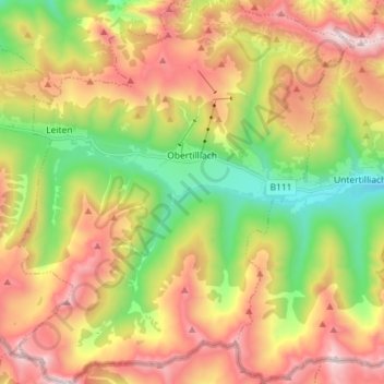
Name: Obertilliach topographic map, elevation, terrain.
Location: Obertilliach, Bezirk Lienz, 9942, Austria (46.65136 12.54971 46.74963 12.67892)
Average elevation: 1,842 m
Minimum elevation: 1,194 m
Maximum elevation: 2,578 m
Thank you for supporting this site ❤️
Make a donation
Make a donation
Gear up for your next adventure:
As an Amazon Associate, this site earns from qualifying purchases at no extra cost to you.