Geolocate

Innsbruck topographic map

Click on the map to display elevation.

About this map

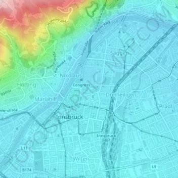
Name: Innsbruck topographic map, elevation, terrain.

Location: Innsbruck, Statutarstadt Innsbruck, Tyrol, Austria (47.25837 11.38119 47.28086 11.41818)

Average elevation: 611 m

Minimum elevation: 567 m

Maximum elevation: 878 m

Gear up for your next adventure:

🚲MTB Frame Bag - Carry tools and maps directly on your bicycle frame
🕶️Polarized Sunglasses - Reduces glare from snow and water at high elevations
💡LED Camping Lantern - Illuminate your campsite with long-lasting lanterns
💧Hydration Bladder - Hands-free hydration solution for long treks
🥾Hiking Shoes - Durable and comfortable shoes for trail hiking

As an Amazon Associate, this site earns from qualifying purchases at no extra cost to you.