Geolocate

Maurach topographic map

Click on the map to display elevation.

About this map

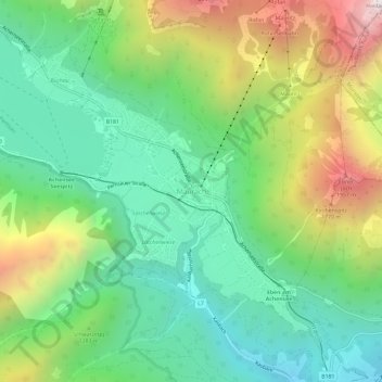
Name: Maurach topographic map, elevation, terrain.

Location: Maurach, Eben am Achensee, Bezirk Schwaz, Tyrol, 6212, Austria (47.40390 11.72981 47.44390 11.76981)

Average elevation: 1,197 m

Minimum elevation: 683 m

Maximum elevation: 2,179 m

Other topographic maps

Click on a map to view its topography, its elevation and its terrain.

Achensee

Austria > Tyrol > Bezirk Schwaz > Eben am Achensee > Pertisau

Average elevation: 1,340 m

Gear up for your next adventure:

Bushcraft Tarp - Versatile emergency shelter or gear protection
🥾All-Terrain Hiking Boots - Versatile boots for varied hiking conditions
👟Sport Hiking Sandals - Breathable footwear for water crossings and camp rest
🥾Light Hiking Boots - Lightweight and comfortable boots for day hikes
Camping Tent - Weather-resistant tents suitable for 2 to 6 people

As an Amazon Associate, this site earns from qualifying purchases at no extra cost to you.