Geolocate

Gschnitztal topographic map

Click on the map to display elevation.

About this map

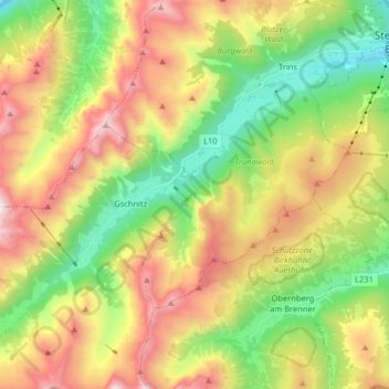
Name: Gschnitztal topographic map, elevation, terrain.

Location: Gschnitztal, Trins, Bezirk Innsbruck-Land, Tyrol, Austria (47.00809 11.29562 47.09403 11.46622)

Average elevation: 1,829 m

Minimum elevation: 989 m

Maximum elevation: 3,090 m

Gear up for your next adventure:

🧦Crew Hiking Socks - Comfortable socks for long-distance hikes
🥾Mountain Hiking Boots - High-traction boots for rocky terrain
🧰Survival Kit - Essential gear for emergencies in the wilderness
🪜Heavy Duty Carabiners - Multi-use clips for securing gear to your backpack
👖Convertible Hiking Pants - Zip-off legs to adapt to changing weather conditions

As an Amazon Associate, this site earns from qualifying purchases at no extra cost to you.