Geolocate

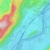
Bad Häring topographic map

Click on the map to display elevation.

About this map

Name: Bad Häring topographic map, elevation, terrain.

Location: Bad Häring, Bezirk Kufstein, Tyrol, 6323, Austria (47.49204 12.09689 47.52594 12.15106)

Average elevation: 704 m

Minimum elevation: 485 m

Maximum elevation: 1,510 m

Other topographic maps

Click on a map to view its topography, its elevation and its terrain.
Maistaller Lacke

Austria > Tyrol > Bezirk Kufstein > Kufstein > Morsbach

Average elevation: 587 m

Karspitze

Austria > Tyrol > Bezirk Kufstein > Rettenschöss

Average elevation: 980 m

Oberau

Austria > Tyrol > Bezirk Kufstein > Wildschönau

Average elevation: 1,102 m

Bänken

Austria > Tyrol > Bezirk Kufstein > Thiersee > Hinterthiersee

Average elevation: 935 m

Maistaller Lacke

Austria > Tyrol > Bezirk Kufstein > Kufstein > Morsbach

Average elevation: 587 m

Maistaller Lacke

Austria > Tyrol > Bezirk Kufstein > Kufstein > Morsbach

Average elevation: 587 m

Maistaller Lacke

Austria > Tyrol > Bezirk Kufstein > Kufstein > Morsbach

Average elevation: 587 m

Maistaller Lacke

Austria > Tyrol > Bezirk Kufstein > Kufstein > Morsbach

Average elevation: 587 m

Maistaller Lacke

Austria > Tyrol > Bezirk Kufstein > Kufstein > Morsbach

Average elevation: 587 m

Oberau

Austria > Tyrol > Bezirk Kufstein > Wildschönau

Average elevation: 1,102 m

Gear up for your next adventure:

🧊Portable Cooler - Keep food and drinks cold during outdoor adventures
🪑Insulated Seat Pad - Protect your seat from cold rocks and wet logs
🔭Compact Monocular - One-handed bird watching and trail spotting
🧥Fleece Jacket - Warm and lightweight jacket for layering
🦌Outdoor Trail Camera - Monitor wildlife activity near your favorite spots

As an Amazon Associate, this site earns from qualifying purchases at no extra cost to you.