
Thank you for supporting this site ❤️
Make a donation
Make a donation
Gear up for your next adventure:
As an Amazon Associate, this site earns from qualifying purchases at no extra cost to you.
Kirchberg topographic map
Click on the map to display elevation.
Thank you for supporting this site ❤️
Make a donation
Make a donation
Gear up for your next adventure:
As an Amazon Associate, this site earns from qualifying purchases at no extra cost to you.
About this map
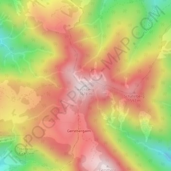
Name: Kirchberg topographic map, elevation, terrain.
Location: Kirchberg, Waidring, Bezirk Kitzbühel, Tyrol, 6392, Austria (47.53773 12.53556 47.53783 12.53566)
Average elevation: 1,389 m
Minimum elevation: 1,029 m
Maximum elevation: 1,652 m
Thank you for supporting this site ❤️
Make a donation
Make a donation
Gear up for your next adventure:
As an Amazon Associate, this site earns from qualifying purchases at no extra cost to you.