
Troll tongue topographic map
Interactive map
Click on the map to display elevation.
About this map
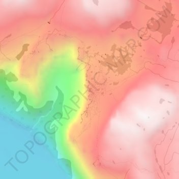
Name: Troll tongue topographic map, elevation, terrain.
Location: Troll tongue, Ullensvang, Vestland, Norway (60.13290 6.75399 60.13300 6.75409)
Average elevation: 1,091 m
Minimum elevation: 447 m
Maximum elevation: 1,469 m
Other topographic maps
Click on a map to view its topography, its elevation and its terrain.
Nordland
In the geological past, a collision with Greenland pushed long slices of the seabed on top of the existing bedrock, today forming the bedrock from Dovrefjell and Trollheimen south of Trondheim stretching north in Trøndelag and through Nordland to justh north of Tromsø. This Cambrian—Silurian bedrock, much…
Average elevation: 259 m