Geolocate

Tynset topographic map

Click on the map to display elevation.

About this map

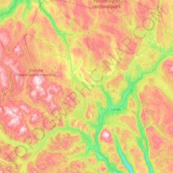
Name: Tynset topographic map, elevation, terrain.

Location: Tynset, Innlandet, Norway (62.02298 10.00573 62.69693 11.21752)

Average elevation: 911 m

Minimum elevation: 391 m

Maximum elevation: 1,650 m

Other topographic maps

Click on a map to view its topography, its elevation and its terrain.

Langedrag

Norway > Innlandet

Average elevation: 425 m

Li

Norway > Innlandet > Skammestein

Average elevation: 774 m

Gear up for your next adventure:

🥾Hiking Boots - Sturdy boots providing ankle support and traction on rugged trails
🛏️Sleeping Bag - Warm and compact sleeping bags for outdoor camping
🪜Heavy Duty Carabiners - Multi-use clips for securing gear to your backpack
🧰Emergency Multi-Tool - Compact multi-tool for outdoor survival
👖Convertible Hiking Pants - Zip-off legs to adapt to changing weather conditions

As an Amazon Associate, this site earns from qualifying purchases at no extra cost to you.