Geolocate

Molde topographic map

Click on the map to display elevation.

About this map

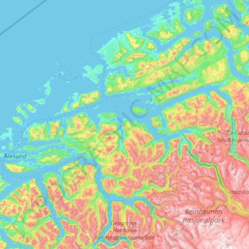
Name: Molde topographic map, elevation, terrain.

Location: Molde, Møre og Romsdal, Norway (62.33174 6.44700 62.87144 8.73165)

Average elevation: 712 m

Minimum elevation: -2 m

Maximum elevation: 2,252 m

Other topographic maps

Click on a map to view its topography, its elevation and its terrain.

Bolten

Norway > Møre og Romsdal

Average elevation: 859 m

Gear up for your next adventure:

💧Filtered Water Bottle - Safe drinking water on the go
🥾Trail Hiking Socks - Comfortable socks to prevent blisters and fatigue
🥾Trail Hiking Shoes - Durable shoes designed for rugged trails
Camping Groundsheet - Protect your tent from moisture and dirt
❄️Traction Ice Cleats - Slip-on spikes for icy trails and winter hiking

As an Amazon Associate, this site earns from qualifying purchases at no extra cost to you.