Geolocate

Tingvoll topographic map

Click on the map to display elevation.

About this map

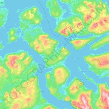
Name: Tingvoll topographic map, elevation, terrain.

Location: Tingvoll, Møre og Romsdal, Norway (62.78155 7.83651 63.12938 8.44064)

Average elevation: 199 m

Minimum elevation: -1 m

Maximum elevation: 1,145 m

Other topographic maps

Click on a map to view its topography, its elevation and its terrain.

Bolten

Norway > Møre og Romsdal

Average elevation: 859 m

Gear up for your next adventure:

🧢Hiking Hat - Sun-protective and breathable hats for long treks
🐕Hiking Dog Pack - Let your canine companion carry their own water and food
🧣Evaporative Cooling Towel - Beat the heat during intense summer climbs
🦯Trekking Poles - Reduced impact on joints for steep topographic climbs
🔦UV Flashlight - Detect minerals or specific insects in the dark

As an Amazon Associate, this site earns from qualifying purchases at no extra cost to you.