Geolocate

Frogner topographic map

Click on the map to display elevation.

About this map

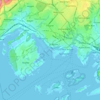
Name: Frogner topographic map, elevation, terrain.

Location: Frogner, Oslo, Norway (59.88363 10.64624 59.93547 10.73537)

Average elevation: 20 m

Minimum elevation: -2 m

Maximum elevation: 140 m

Gear up for your next adventure:

🥫Freeze-Dried Meals - Lightweight, high-calorie nutrition for multi-day treks
🦟Insect Repellent - Keep mosquitoes and black flies away in wooded areas
🔦LED Headtorch - Bright and durable light for night activities
🧦Merino Wool Socks - Moisture-wicking comfort for long-distance hiking
🧊Portable Cooler - Keep food and drinks cold during outdoor adventures

As an Amazon Associate, this site earns from qualifying purchases at no extra cost to you.