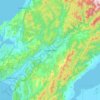
Southland topographic map
Click on the map to display elevation.
Southland
Fiordland has a wet mountain climate though conditions vary due to altitude and exposure. Rainfall is the highest in the country and varies between 6,500 and 7,500 mm annually. The farthest coastal reaches of Fiordland are characterized by a limited temperature range with increasing rainfall at higher altitudes. The moist wet climate is influenced by approaching low-pressure systems which sweep across the country entering Fiordland.
About this map
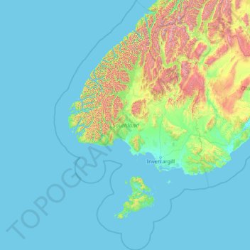
Name: Southland topographic map, elevation, terrain.
Location: Southland, New Zealand (-47.72405 166.13860 -44.12645 169.34202)
Average elevation: 229 m
Minimum elevation: -2 m
Maximum elevation: 2,753 m
Other topographic maps
Click on a map to view its topography, its elevation and its terrain.
Reserve
New Zealand > Northland > Far North District > Bay of Islands-Whangaroa Community > Kerikeri
Average elevation: 56 m
Russell
New Zealand > Northland > Far North District > Bay of Islands-Whangaroa Community
Average elevation: 12 m
Greymouth
New Zealand > West Coast > Grey District
A combination of high intensity rainfall, high topographic relief and short steep rivers often leads to rapid flooding of low-lying land across the West Coast. Since its founding Greymouth has experienced two dozen floods by the Grey River, with many of the most significant being assigned names: for example,…
Average elevation: 40 m
Cape Kidnappers / Te Kauwae-a-Māui
New Zealand > Hawke's Bay > Hastings District
Average elevation: 16 m
Orepuki
New Zealand > Southland > Southland District > Tuatapere Te Waewae Community
Average elevation: 22 m
Saint Peters
New Zealand > Northland > Far North District > Bay of Islands-Whangaroa Community
Average elevation: 46 m