Geolocate

Barometer topographic map

Interactive map

Click on the map to display elevation.

About this map

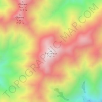
Name: Barometer topographic map, elevation, terrain.

Location: Barometer, Marlborough, 7240, New Zealand (-41.83010 173.64496 -41.83000 173.64506)

Average elevation: 1,397 m

Minimum elevation: 898 m

Maximum elevation: 1,780 m

Other topographic maps

Click on a map to view its topography, its elevation and its terrain.

Picton

New Zealand > Marlborough

Picton, Marlborough, 7220, New Zealand

Average elevation: 193 m

Queen Charlotte Sound / Tōtaranui

New Zealand > Marlborough

Queen Charlotte Sound / Tōtaranui, Marlborough, New Zealand

Average elevation: 24 m

Marlborough

New Zealand > Marlborough

Marlborough, New Zealand

Average elevation: 312 m

Mitre Peak

New Zealand > Marlborough

Mitre Peak, Marlborough, New Zealand

Average elevation: 1,223 m