
Patata topographic map
Click on the map to display elevation.
About this map
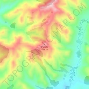
Name: Patata topographic map, elevation, terrain.
Average elevation: 356 m
Minimum elevation: 220 m
Maximum elevation: 519 m
Other topographic maps
Click on a map to view its topography, its elevation and its terrain.
Tongariro National Park
New Zealand > Manawatu-Whanganui > Ruapehu District
The first activities in the young Tongariro National Park were the construction of tourist huts at the beginning of the 20th century. But it was not before opening of the railway in 1908 and the building of roads in the 1930s that a significant number of people visited the park. The second Tongariro National…
Average elevation: 888 m